Beyond Product Design - Architecture
How to Bury a Building
A final architecture thesis that isn't really a proposal - it's a mirror. Haifa is already burying a derelict cigarette factory, slowly, through neglect and the waste of new construction; I staged that burial literally, to force the city to look at what it's already doing.
- Role
- Solo - Research, Concept & Design
- Institution
- Technion – Israel Institute of Technology
- Timeline
- Completed August 2022
- Site
- Kibbutz Galuyot, Haifa
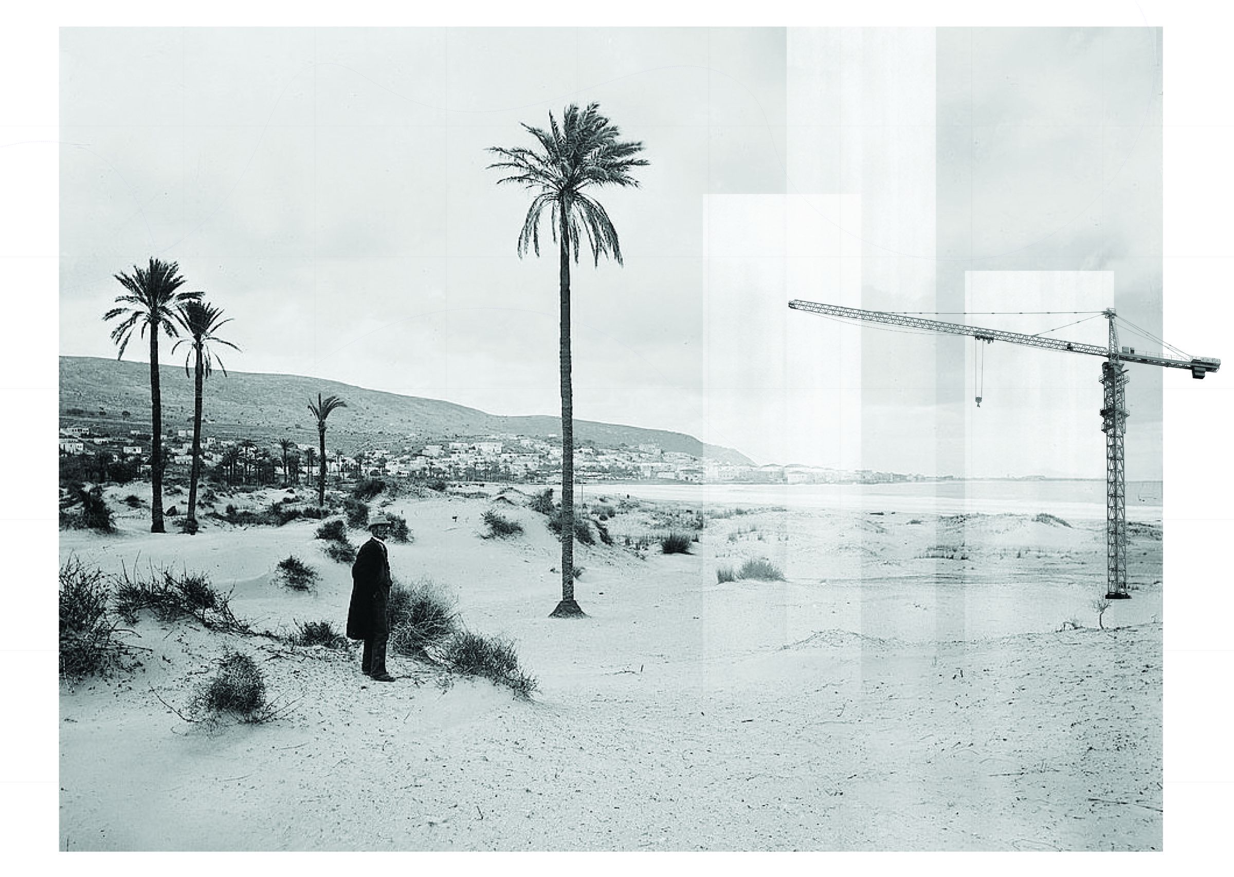
How to Bury a Building is my M.Arch final thesis, developed independently in my last year at the Technion. It's a critique, not a proposal. It centers on a derelict early-1900s cigarette factory in Haifa's Lower City - one of dozens of buildings the city has declared “protected” while quietly letting them decay under the shadow of a new development next door. Rather than designing a restoration, I built a mirror: an unbuilt mega-structure that literally buries the site's historic buildings in crushed construction waste, taking the city's own quiet erasure and staging it, physically and unavoidably, as an act of burial.
Past, Present, Future
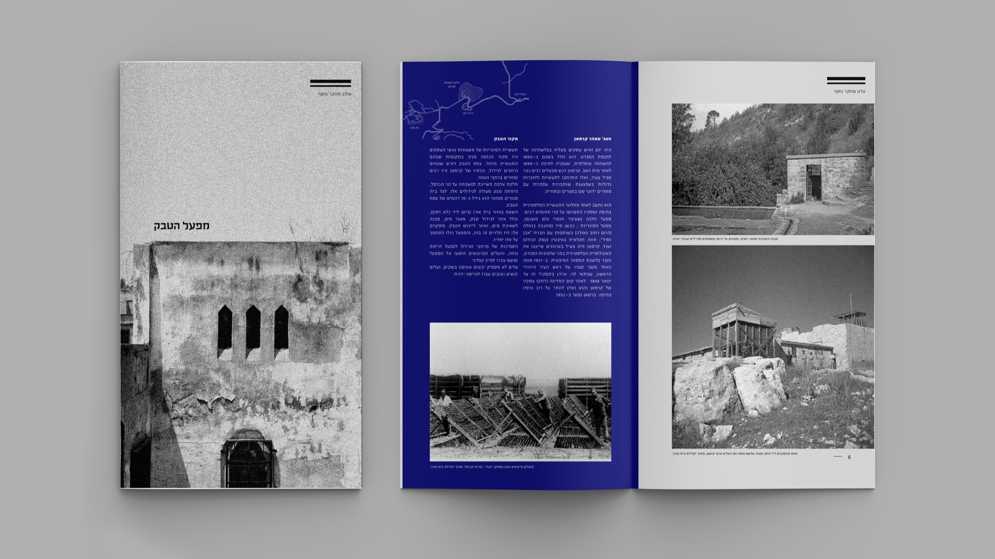
I'm from Haifa, but it took me a long time - and an architecture degree - to really see the city I grew up in. On a daily commute, I kept passing the ruined façade of the same abandoned building: an early-1920s cigarette factory of unknown architect, built and once run by three Arab businessmen - Hajj Taher Karaman, Hassan Dick, and Farah Salti. During the British Mandate it was an active, thriving business. Today it stands gutted, one of dozens of derelict structures scattered across the same stretch of the Lower City - each holding a fragment of a story that is also the story of three families who lost everything in 1948.
Haifa's history reads as a sequence of peaks and collapses. Ottoman rule left a small town that grew, was destroyed, and was rebuilt more than once. Under the British Mandate the city became a cosmopolitan port - a new railway, a large harbor, a booming industrial belt - and, alongside it, a genuinely unique modernist architecture: functionalist buildings shaped jointly by émigré Jewish architects and local Arab builders and craftsmen, reaching a richness found nowhere else. The declaration of the state in 1948 brought the opposite: a wave of demolitions tore through Arab homes, public buildings, and places of worship across the Lower City, leaving behind a torn urban fabric and, at its center, islands of ruin.
In recent years, Haifa's planning department has added a small number of surviving buildings to an official heritage list. Homemade signs - clearly not put up by the municipality - have started appearing on some of them, announcing their protected status to passers-by: a paradox in itself. Preservation in Haifa is mostly blocked by economics, and underneath the economics, I could also feel a political reluctance to engage with this specific history. So a “heritage-listed” building here mostly just means a building left standing exactly as it is - an aging white elephant, on a good day eventually restored, and on an ordinary day quietly left to decay, or erased and buried outright. Even where the landscape looks green and pleasant today, it's often just this - a demolished neighborhood in disguise: one more of what Israeli conservation architect Amnon Bar-Or calls spaces of embarrassment - places where, the moment you enter them, you can tell something is wrong.
Kibbutz Galuyot, on the city's low ground
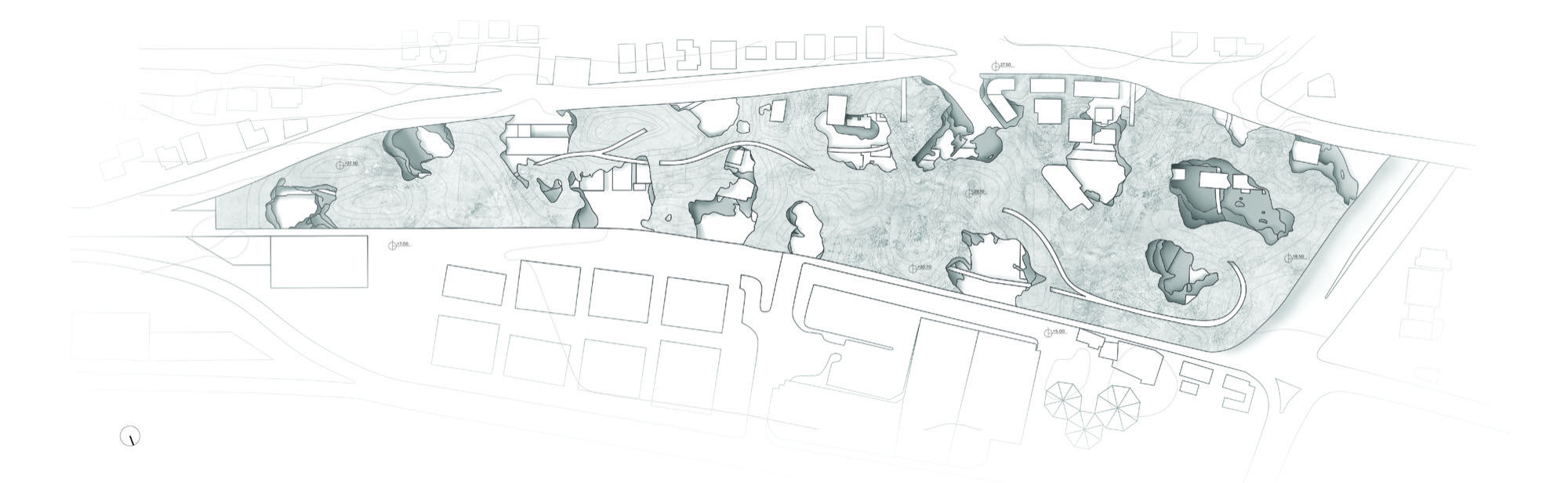
The intervention site sits in Haifa Bay, in a neighborhood called Kibbutz Galuyot, part of the historic Lower City, next to Halisa and Tel Amal and directly across from the new central business district currently planned for the area. It covers about 90 dunams (9 hectares) and holds roughly 50 existing structures - six of which the municipality has added to its heritage list. Alongside them stands an intact stretch of urban fabric built in the early 1930s: a row of historic stone houses with distinctive arches and ironwork, most now empty or in poor repair, with only a handful of families still living among them.
Physically, the site sits right on the seam between the mountain and the coastal plain, giving it a real topographic slope that makes it hard to move through, and hemming it in on three sides with major roads that cut it off from the surrounding fabric entirely - an urban enclave in the middle of the city. Its many open green spaces aren't really parks; they're the leftover, unbuilt scraps of a demolished neighborhood - more of Bar-Or's spaces of embarrassment in landscaped disguise. Socio-economically this is one of Haifa's poorer areas, and the physical neglect and crumbling infrastructure show it: the site's unusually high concentration of abandoned buildings has become fertile ground for crime.
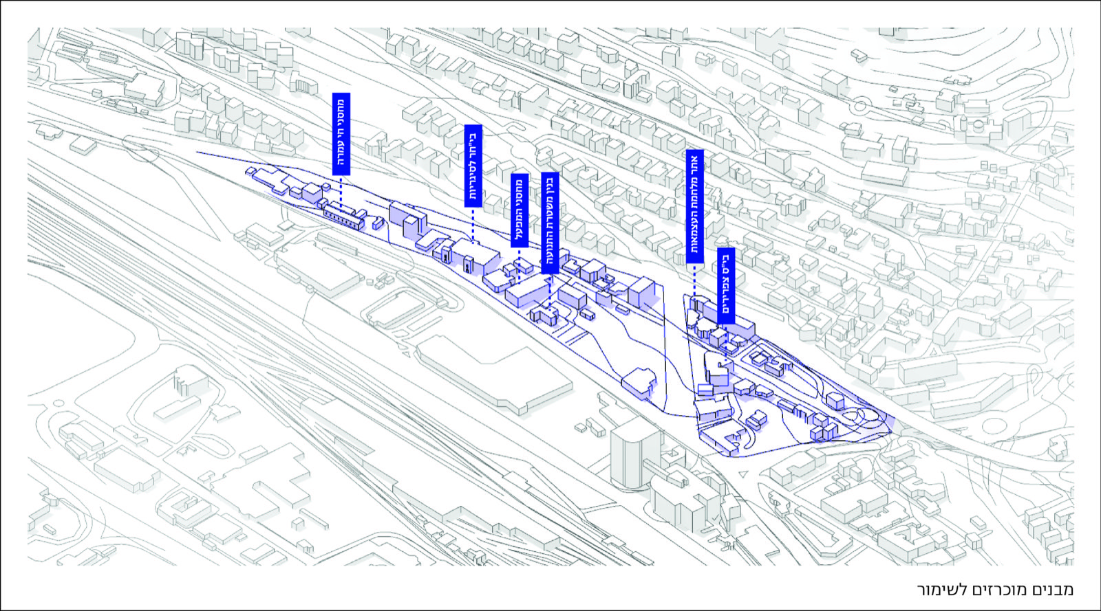
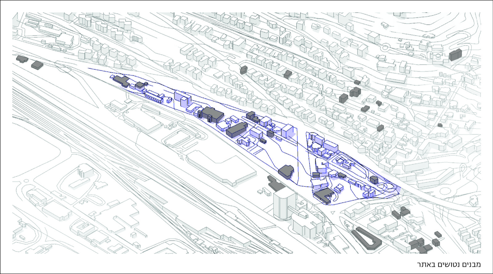
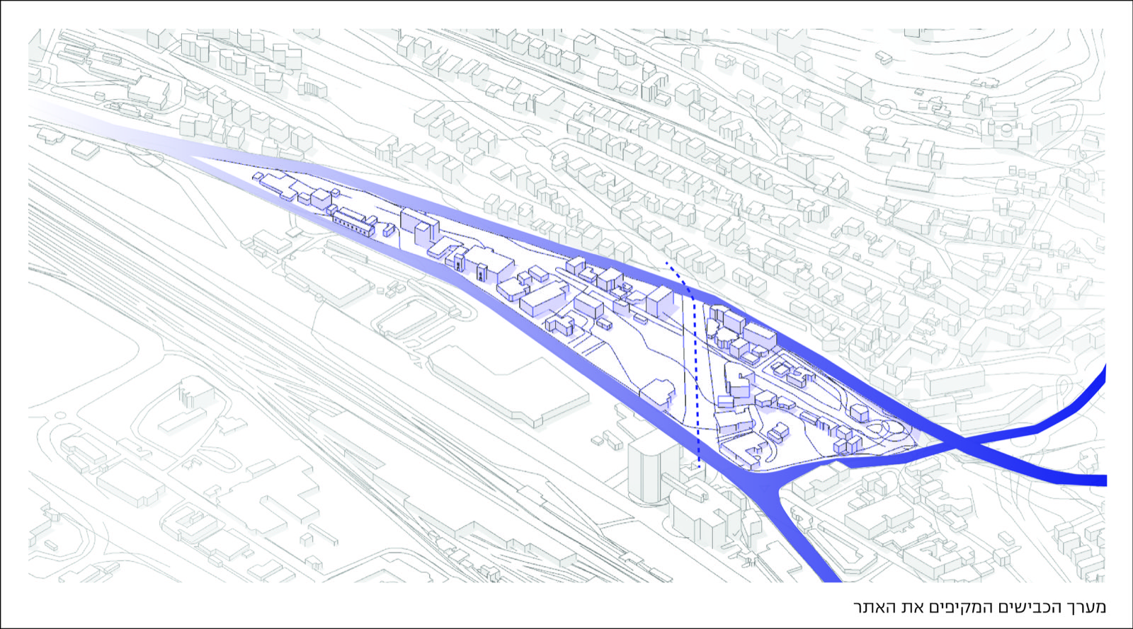
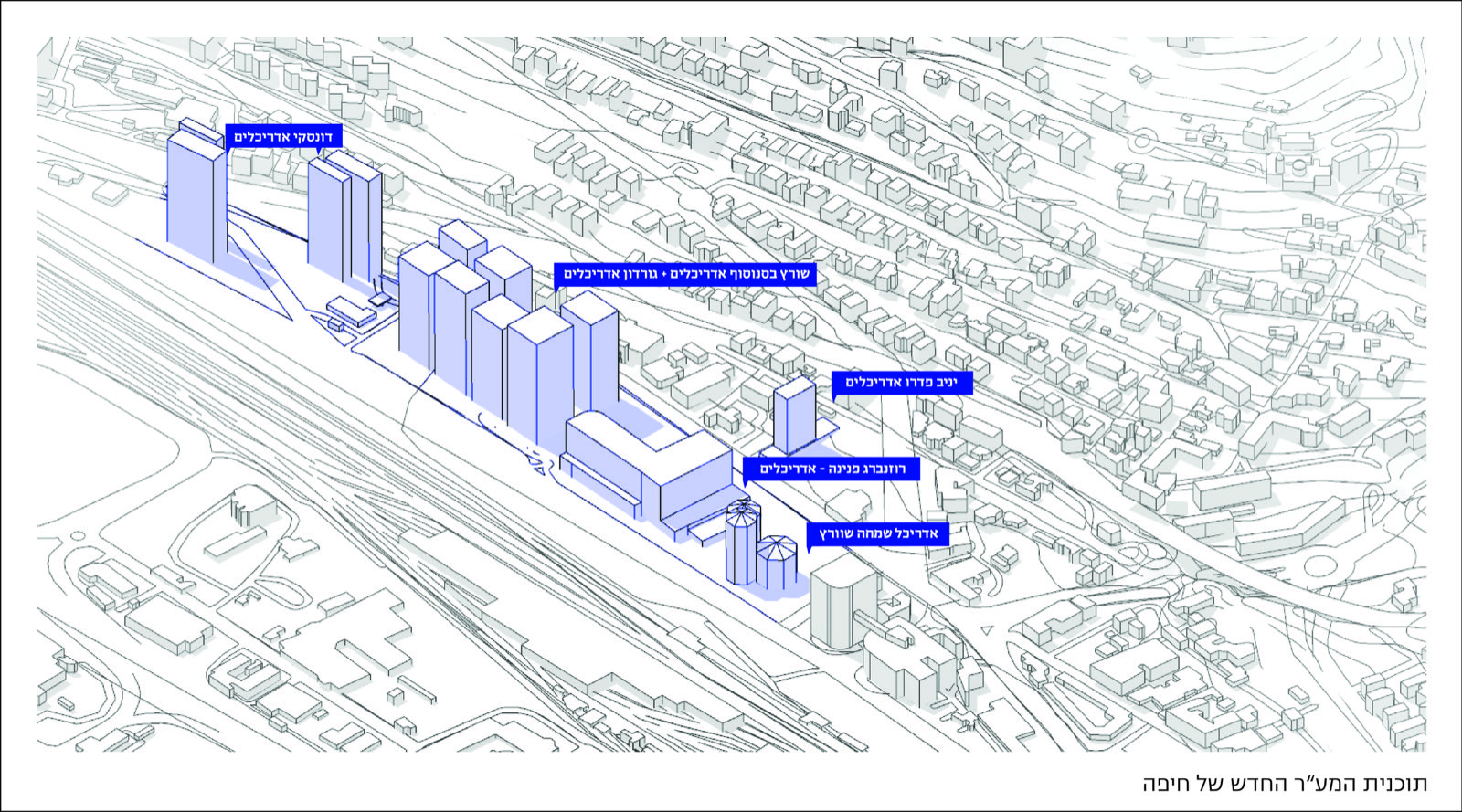
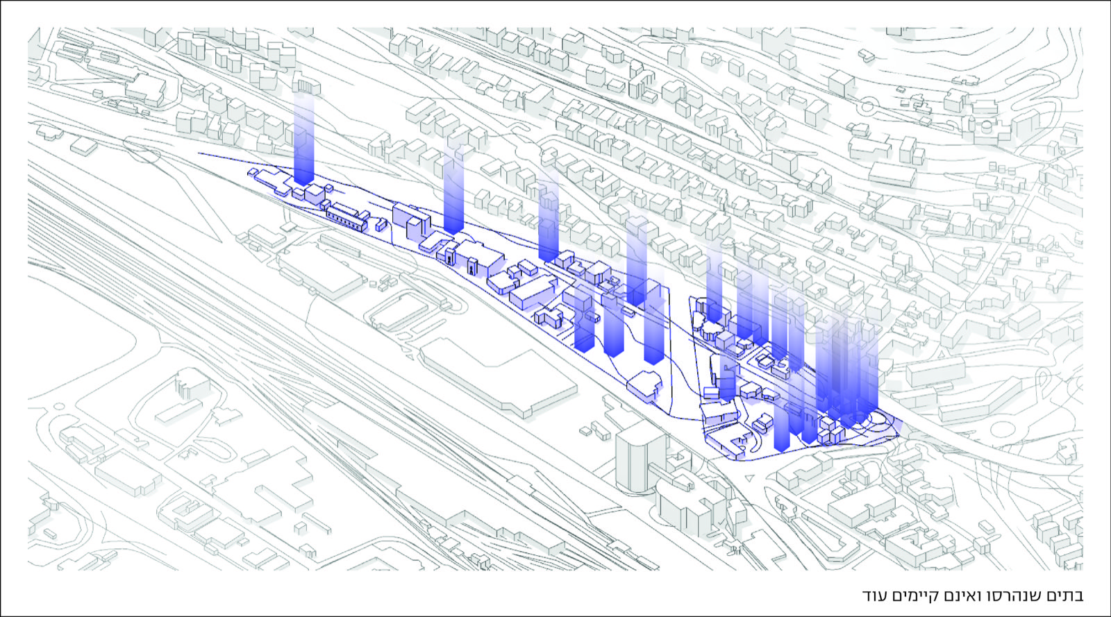
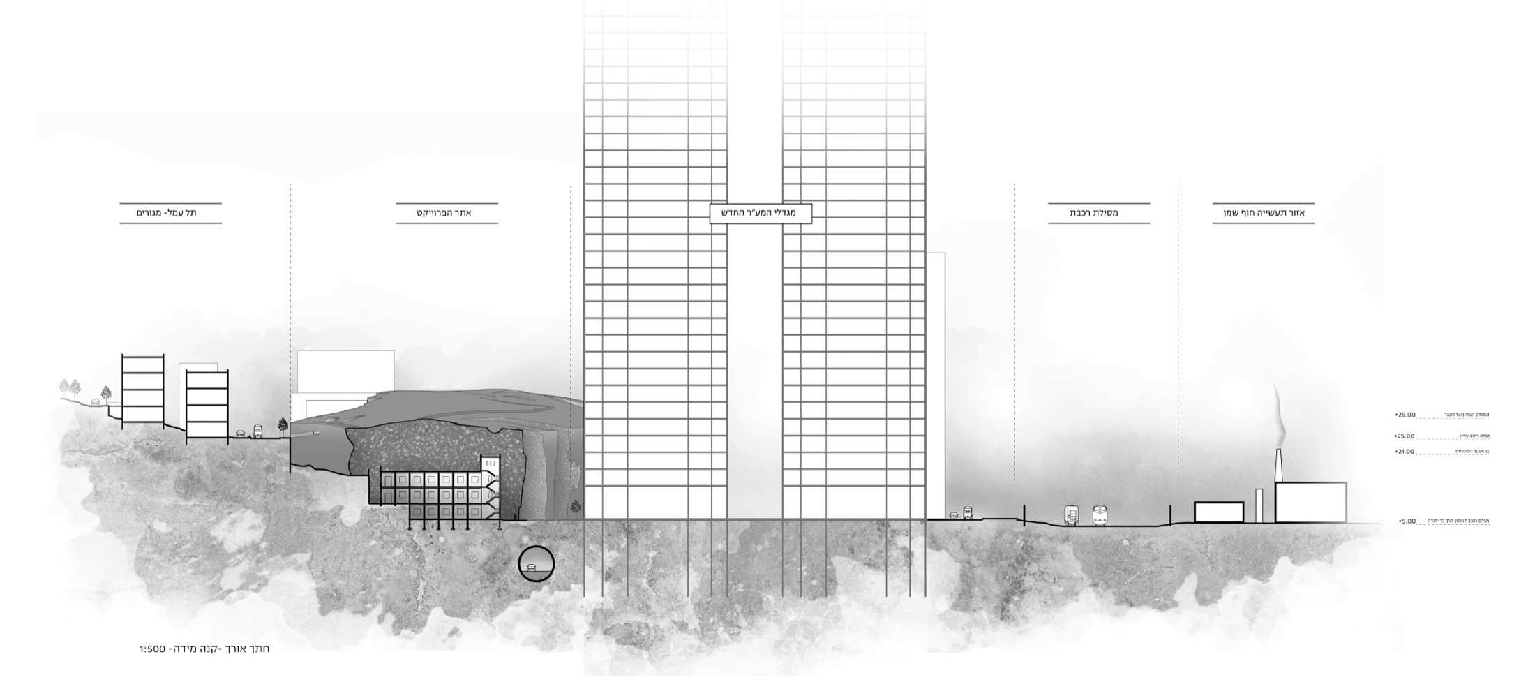
The city's next master plan calls for exactly this kind of intensification directly opposite the site - towers, offices, schools, elder housing, a tunnelled main road with a public plaza above it, and carefully landscaped planting. Renderings from the planning offices show a telling contrast: gleaming new high-rises on one side of the road, and on the other, the same cigarette factory, still neglected and abandoned.
Architectural burial
Modern development tends to solve the problem of an old building by replacing it, rather than reusing or reinforcing what already exists - and every act of new construction leaves behind its own trail of waste. This project treats that waste as the material of preservation, rather than its opposite. Instead of restoring the factory and its neighboring structures, I propose burying them - deliberately, visibly - beneath a mega-structure built from the site's own future construction waste. Concrete rubble that would otherwise be trucked to the new CBD site and landfilled is instead collected, crushed, mixed into a concrete aggregate, and cast as the material of the new ground itself.
Looking for the right formal language for this new layer, I turned to geology rather than architecture - studying how stone naturally forms, fractures, and meets other stone. Geological terms translate surprisingly well into the vocabulary of preservation: burying an old layer beneath a new one is really just building a new superposition, in the geological sense of the word - which is also how the project ended up named, half in earnest, half as a provocation: an act of architectural burial.
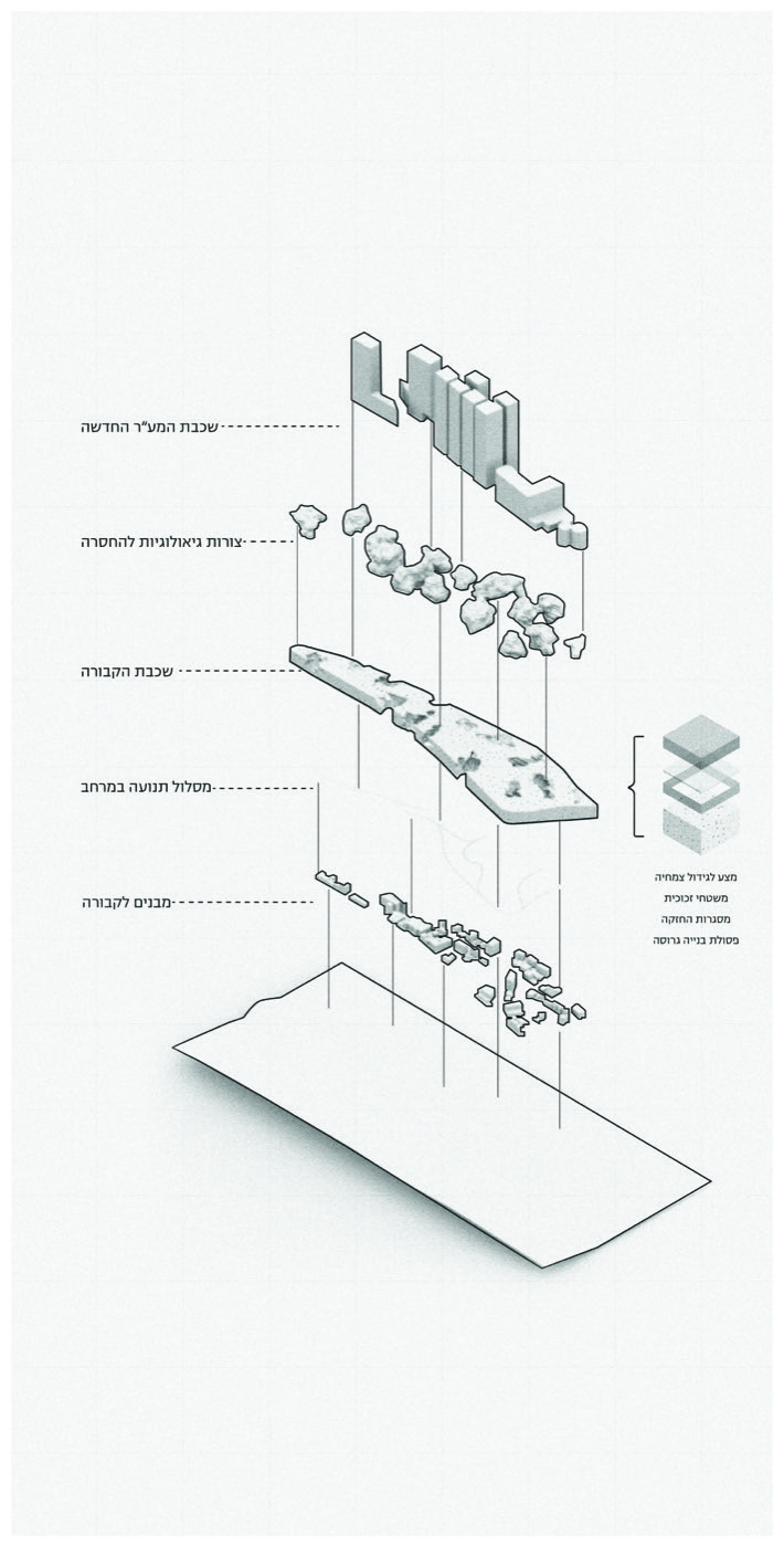
- Construction waste - crushed rubble sourced from the new CBD, otherwise headed for landfill.
- Geological voids - openings subtracted from the mass in geological, not architectural, shapes.
- The burial layer - crushed waste cast into a concrete aggregate, forming a stable structural mass.
- Buried buildings - the site's existing structures, left in place beneath the new ground.
A single mega-structure, cast from crushed construction waste and concrete, covers the site almost completely. Subtracted from its mass - in geological rather than architectural shapes - are voids that open views and physical access down to the buildings buried underneath. Some openings are capped with a walkable glass ceiling, so a visitor can stand directly above a buried building and look down into it. The topmost layer is a bed of soil, thick enough to plant native trees and vegetation - turning the entire roof of the burial structure into a public park for the surrounding neighborhoods.
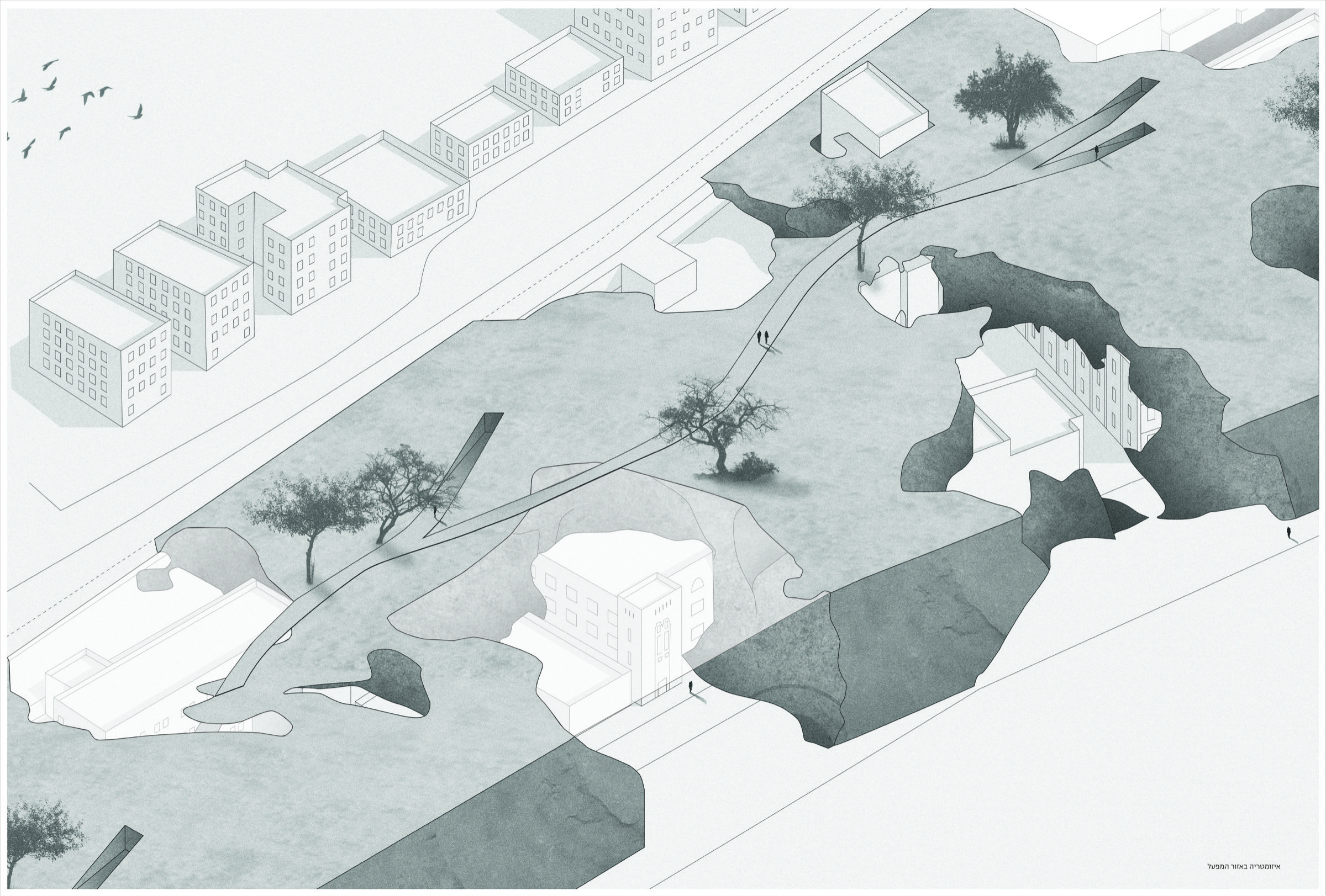
Every opening is placed to protect the buildings beneath it as much as possible, while still surfacing just enough - a rooftop, a window, a doorway - to make clear that a burial happened here, and that an entire world still exists below. The original houses stay partially usable, reachable either from outside the mound or from an internal network of paths, and movement threads through the project on two levels at once: inside the buried structure, and across its surface above.
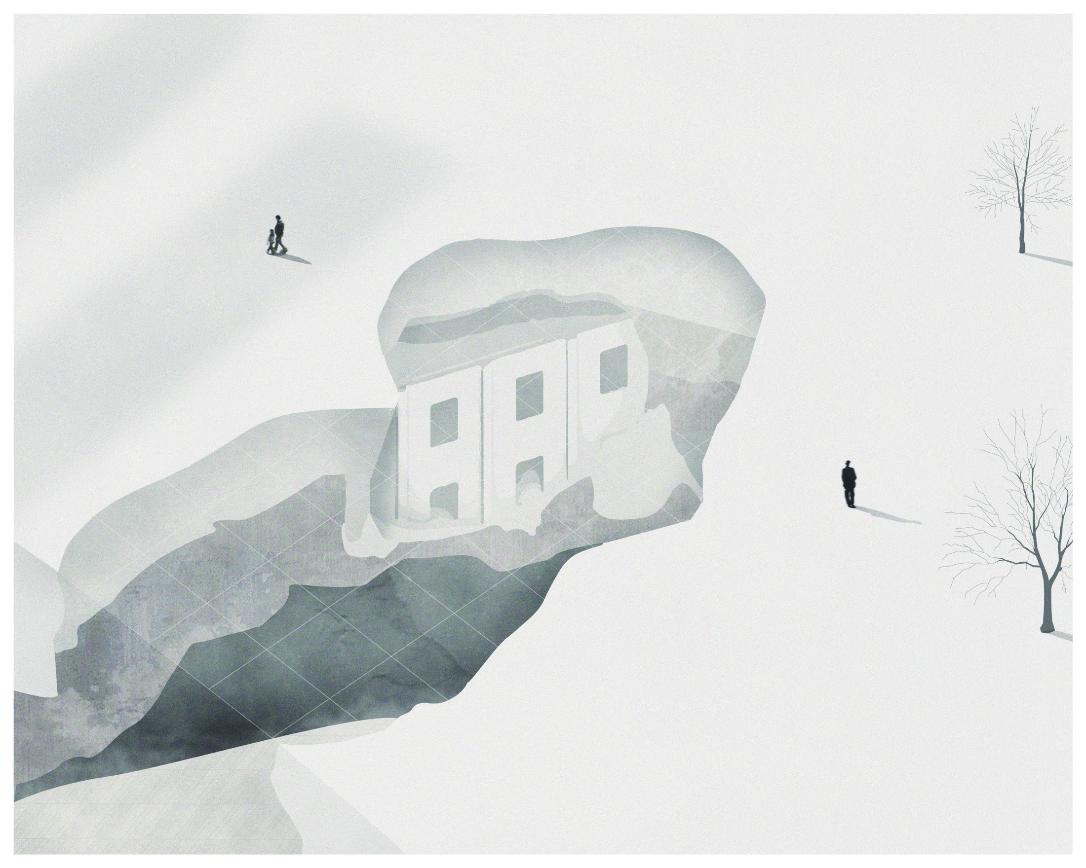
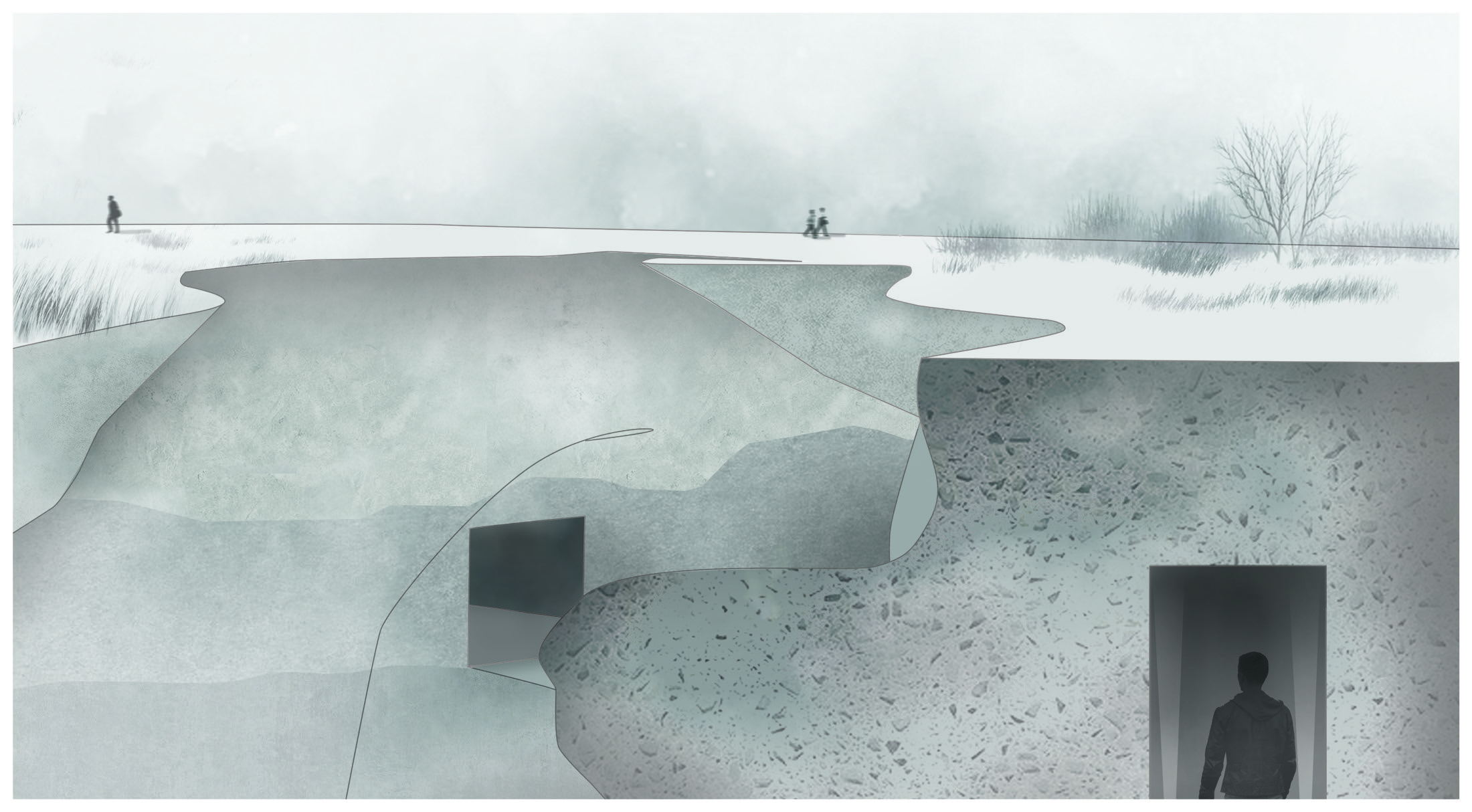
In section, the relationship between the burial mound and the buildings underneath becomes legible: the mound rises to roughly 5 meters above the tallest buried structure, reaching a maximum height of 24 meters above grade at the site's highest point - modest, next to the towers planned across the street.
What I took away
- 01
This thesis isn't meant to be read as a finished, buildable proposal - it's a critique of practices I saw happening around me, in both construction and preservation, and a way of putting into form the shock I felt as a young architecture student watching them play out.
- 02
Working through the geology reference taught me how much a discipline's own vocabulary can reframe a problem - 'burial' and 'superposition' gave me language for an idea that 'renovation' or 'adaptive reuse' never could.
- 03
I hope for a future where preservation, and the values behind it, get taken seriously in planning conversations instead of staying at their margins.
Research, drawings, and the final review
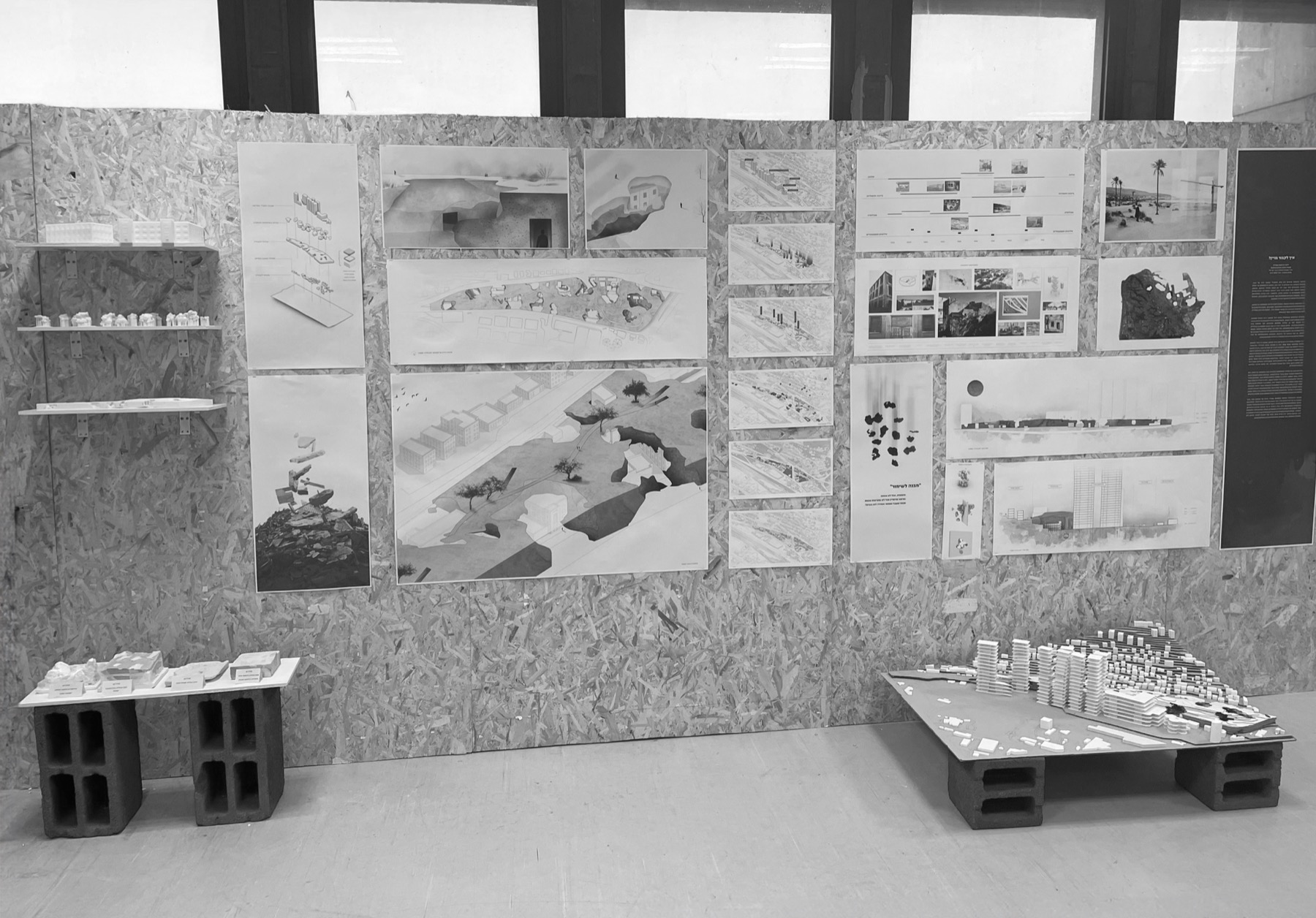
The full project - research, drawings, and final panels - is compiled into a project book, alongside photographs from the final review.
© Designed & built by Lior Shitrit with AI tools.